California Interior Chaparral and Woodlands
The ecoregion’s land area is provided in units of 1,000 hectares. The conservation target is the Global Safety Net (GSN1) area for the given ecoregion. The protection level indicates the percentage of the GSN goal that is currently protected on a scale of 0-10. N/A means data is not available at this time.
Bioregion: Greater California (NA31)
Realm: Northern America
Ecoregion Size (1000 ha):
7,210
Ecoregion ID:
423
Conservation Target:
35%
Protection Level:
2
States: United States: CA
The California Interior Chaparral and Woodlands ecoregion wraps around California’s Central Valley, extending from Shasta Lake in the north to the vicinity of Wheeler Ridge in the south. The ecoregion includes the foothills of the Sierra Nevada Forests ecoregion in the east. It borders the Klamath-Siskiyou ecoregion on the north and northwest and the Northern California Coastal Forests and Santa Lucia Montane Chaparral and Woodlands ecoregions on the west.
Despite its name, it is not entirely interior, touching the Pacific Ocean in the vicinity of San Francisco Bay, Monterey Bay, and from San Simeon south to Point Conception. To the south lie the California Montane Chaparral and Woodlands and the California Coastal Sage and Chaparral ecoregions.
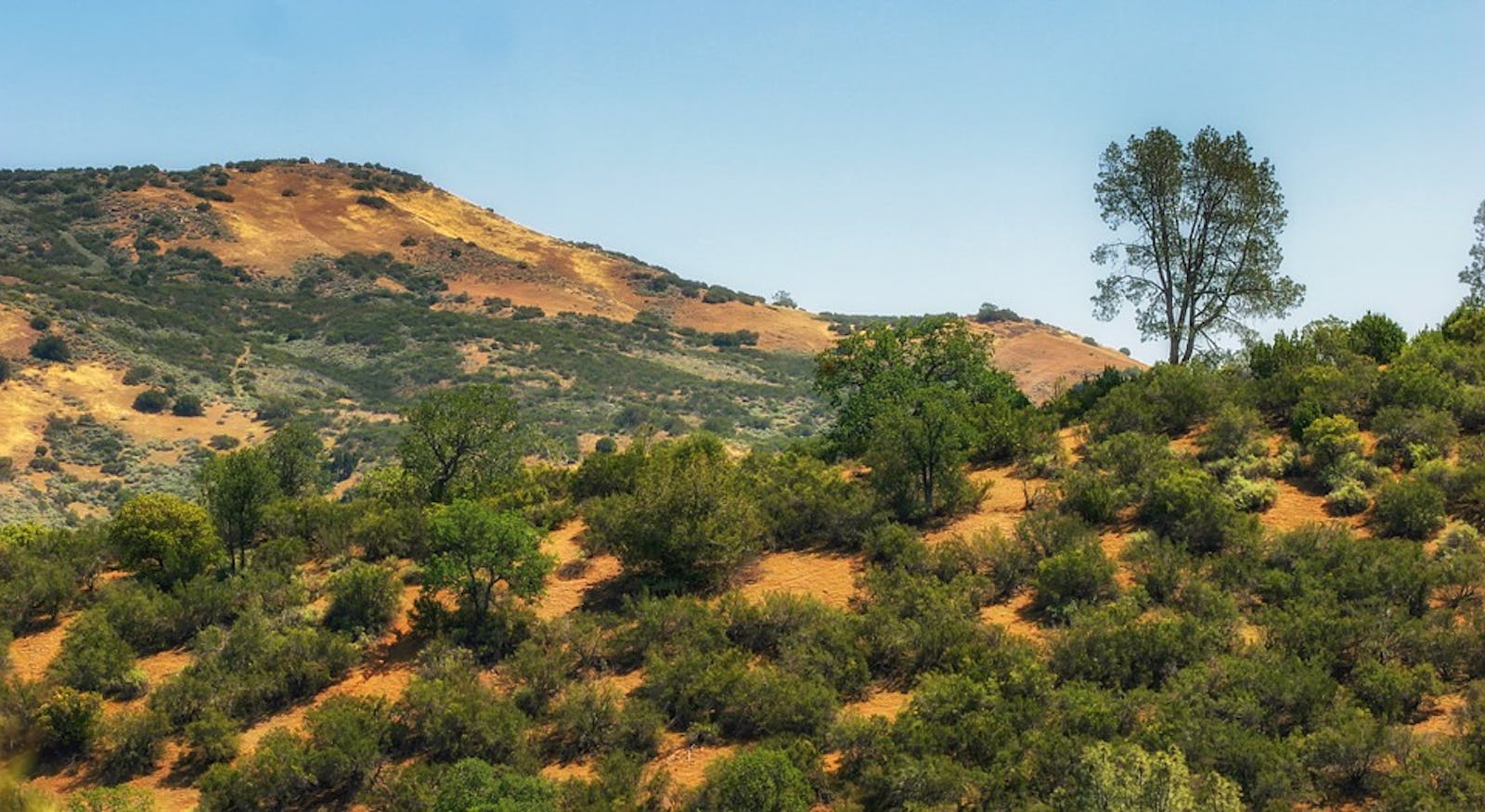
The terrain of the California Interior Chaparral and Woodlands ecoregion is largely hills and low mountains, covered by a biologically rich mosaic of chaparral, grasslands, oak savannas and woodlands, serpentine communities, pine and montane conifer forests, riparian forests, and wetlands. This ecoregion hosts the largest number of endemic mammals of all ecoregions in the U.S. and Canada.

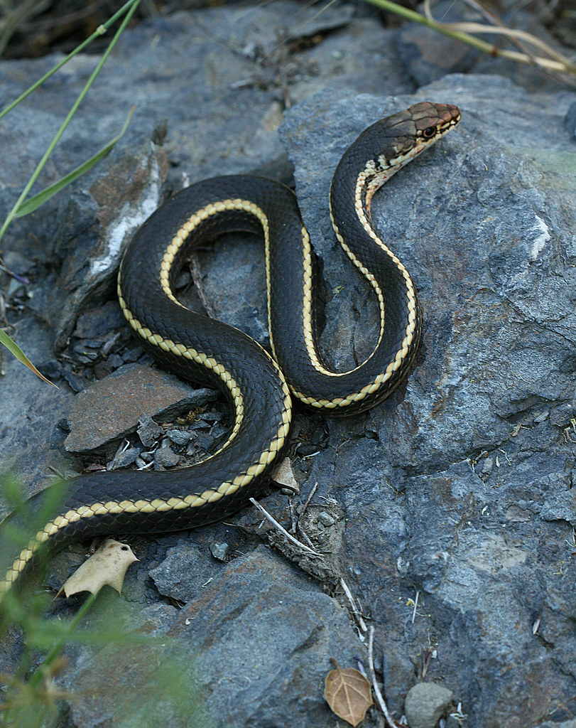
The flagship species of the California Interior Chaparral and Woodlands ecoregion is the Alameda whipsnake (Masticophis lateralis euryxanthus), also known as the Alameda striped racer. Image credit: Philip Bouchard, CC by NC ND 2.0
The climate of this ecoregion is Mediterranean but varies down the long latitudinal gradient and from one side of the Central Valley to the other. San Jose, in the approximate north-south center of the ecoregion, has warm to hot and dry summers, with average daily temperatures around 21°C. Winters are mild to cool and wet, with average daily temperatures around 10°C in December and January. Annual rainfall averages 402 mm.
Along the coast, temperatures are moderated, with warmer winters and cooler summers. The climate is wetter, close to the Sierra Nevada, for example, averaging 968 mm annual precipitation in Placerville.
The most widespread and characteristic natural communities of this ecoregion are oak woodland and chaparral. Valleys are dominated by foothill pine, blue oak, and chaparral species such as California buckeye, several species of manzanita, chamise, redbud, and scrub oak. Other distinctive oaks in this ecoregion are coast live oak, canyon live oak, valley oak, and interior live oak. Other pines include Coulter’s pine, which has the heaviest cone of any pine species, and knobcone pine, whose serotinous (closed) cones open only with the heat of fire, about every 25 to 50 years under a natural fire regime.
Endemic species with narrow ranges are abundant in the ecoregion and often occur in single ranges or on unusual soil types such as serpentine. Endemic species associated with serpentine include Sargent’s cypress, MacNab cypress, leather oak, interior silk tassel, milkwort streptanthus, and Muir’s hairstreak.
One important hotspot of endemism is the maritime chaparral around Monterey Bay, which is home to four endemic manzanitas, among other species. Another hotspot is the Diablo Range, including Mount Diablo, directly east of San Francisco Bay. Endemics there include Mount Diablo manzanita, Mount Diablo fairy-lantern, chaparral bellflower, Mount Diablo bird’s beak, Mount Diablo sunflower, and Mount Diablo buckwheat.

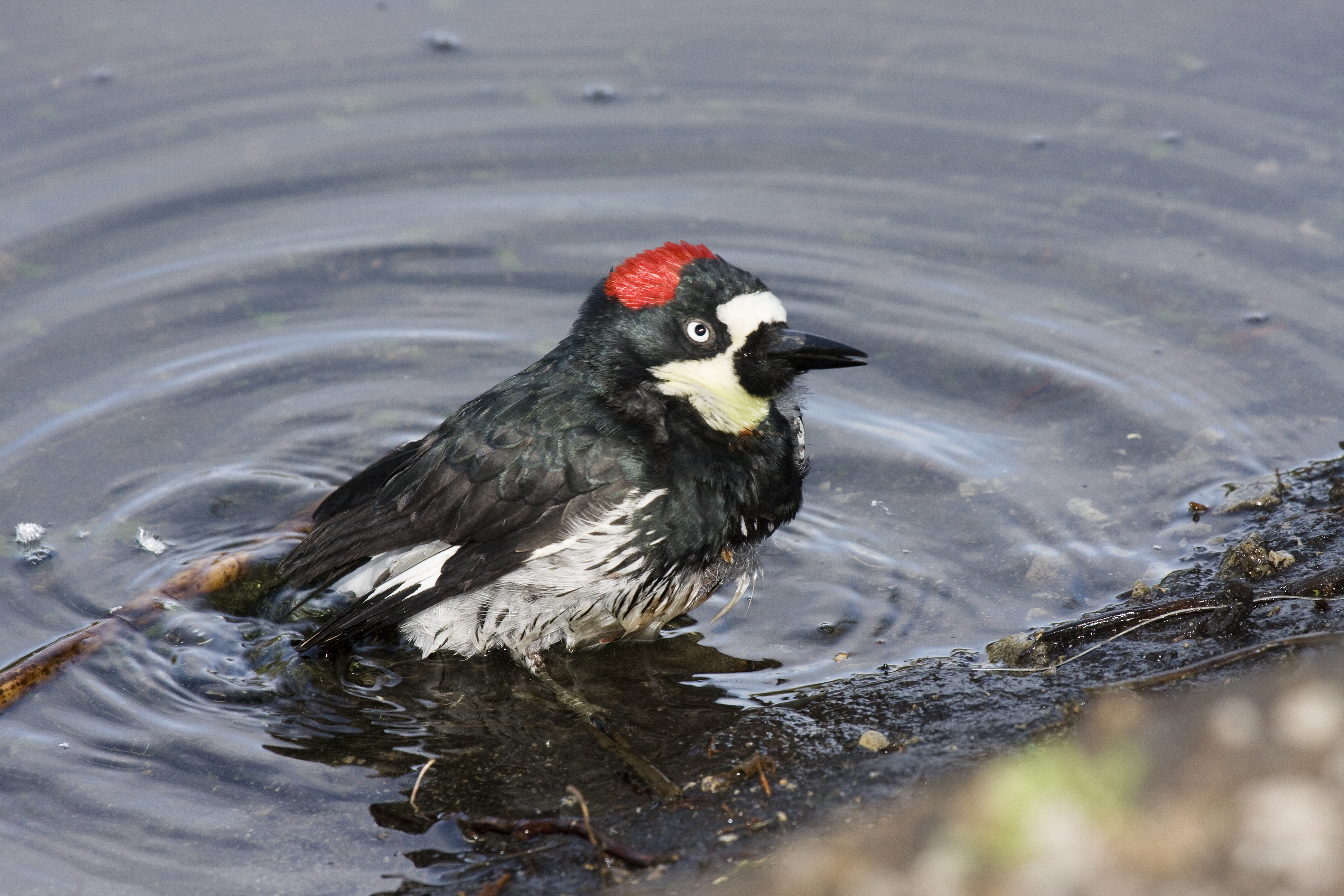
Acorn woodpecker. Image credit: Kevin Cole, Creative Commons
The threatened Alameda striped racer (whipsnake) is almost entirely restricted to two counties in this general area, and the threatened California red-legged frog is still found here. Sandstone-derived soils near Coalinga support disjunct populations of desert species. Some 60 species of mammals dwell in this ecoregion, including at least six endemics and near endemics—three species of kangaroo rats plus the Sonoma chipmunk, Suisun shrew, and salt marsh harvest mouse—the largest number of endemic mammals of all ecoregions in the US and Canada. Among the characteristic birds are northern harrier, white-tailed kite, burrowing owl, Anna’s hummingbird, California scrub-jay, wrentit, and acorn woodpecker. Some 20 pairs of prairie falcons breed in the Diablo Range.
Only 7% of this ecoregion is protected, but with 23% of habitat outside protected areas still intact, opportunities to increase protection are abundant and should be vigorously pursued. Human population growth, urban sprawl, and rural residential development are huge threats to this ecoregion.
Priority conservation actions for the next decade
- Expand the network of protected areas to better represent all natural communities and capture all endemic species.
- Improve management of existing protected areas by emphasizing the most imperiled species and natural communities and their threats.
- Improve land use planning and regulations to reduce the expansion of human footprint and urban sprawl into natural habitats.
-
-
1. Ricketts, T.H. et al. 1999. Terrestrial Ecoregions of North America: A Conservation Assessment. Island Press, Washington, D.C.
2. Keeley, J.E. 2000. Chaparral. Pages 203-253 in M.G. Barbour and W.D. Billings, eds. North American Terrestrial Vegetation, 2nd edition. Cambridge University Press, Cambridge, UK.
3. Sawyer, J.O., and T. Keeler-Wolf. 1995. A Manual of California Vegetation. California Native Plant Society, Sacramento. -
Cite this page: California Interior Chaparral and Woodlands. Ecoregion Snapshots: Descriptive Abstracts of the Terrestrial Ecoregions of the World, 2021. Developed by One Earth and RESOLVE. https://www.oneearth.org/ecoregions/california-interior-chaparral-and-woodlands/
-


