Central US Forest-Grasslands Transition
The ecoregion’s land area is provided in units of 1,000 hectares. The conservation target is the Global Safety Net (GSN1) area for the given ecoregion. The protection level indicates the percentage of the GSN goal that is currently protected on a scale of 0-10. N/A means data is not available at this time.
Bioregion: Midwestern Tallgrass Prairie & Forest Transition (NA21)
Realm: Northern America
Ecoregion Size (1000 ha):
22,858
Ecoregion ID:
387
Conservation Target:
3%
Protection Level:
8
States: United States: KY, IN, IL, WI, MO, IA
The Central US Forest-Grasslands Transition ecoregion occupies a large area between the deciduous forests of the eastern United States and the tallgrass prairies of the eastern Great Plains. It has been ranked among the top ten ecoregions for reptiles, birds, butterflies, and tree species in North America. Most of the non-urban area has been heavily transformed by agriculture, making this one of the most modified ecoregions of North America.
Nevertheless, it contains the boyhood home of legendary preservationist John Muir (Portage, WI), the professional home of pioneer ecologist Victor Shelford and many other notable ecologists (University of Illinois, University of Wisconsin, etc.), and a center of the American natural areas movement, especially in its early years (1950s through 1980s). Conservationists in this ecoregion rightfully place great value in protecting its precious, remnant natural areas.
This ecoregion stretches from north of Green Bay, Wisconsin, where it borders the Upper Midwest US Forest-Savanna Transition ecoregion, to south of St. Louis, Missouri and Carbondale, Illinois, where it borders the Interior Plateau US Hardwood Forests ecoregion. Besides St. Louis, it encompasses the major metropolitan areas of Milwaukee and Chicago, as well as many smaller cities. The climate of the Central US Forest-Grasslands Transition ecoregion ranges from humid warm continental to humid cold temperate. The dominant bedrock is Carboniferous (Pennsylvanian) sedimentary rocks of the Illinois Basin, including dolomite, limestone, shale, and sandstone, but both older (Cambrian) and younger (Eocene) bedrock also occurs in the region.
Most of the ecoregion was covered by the Illinoian glaciation, and more than a third by the last (Wisconsin) glaciation. The southern portion, in Kentucky and southwestern Indiana, was unglaciated. Glacial features such as ground moraines, end moraines, kames, eskers, and outwash deposits are common. Lacustrine (lake) deposits are found in lowlands adjacent to Lake Michigan and in inland areas of former glacial lakes.

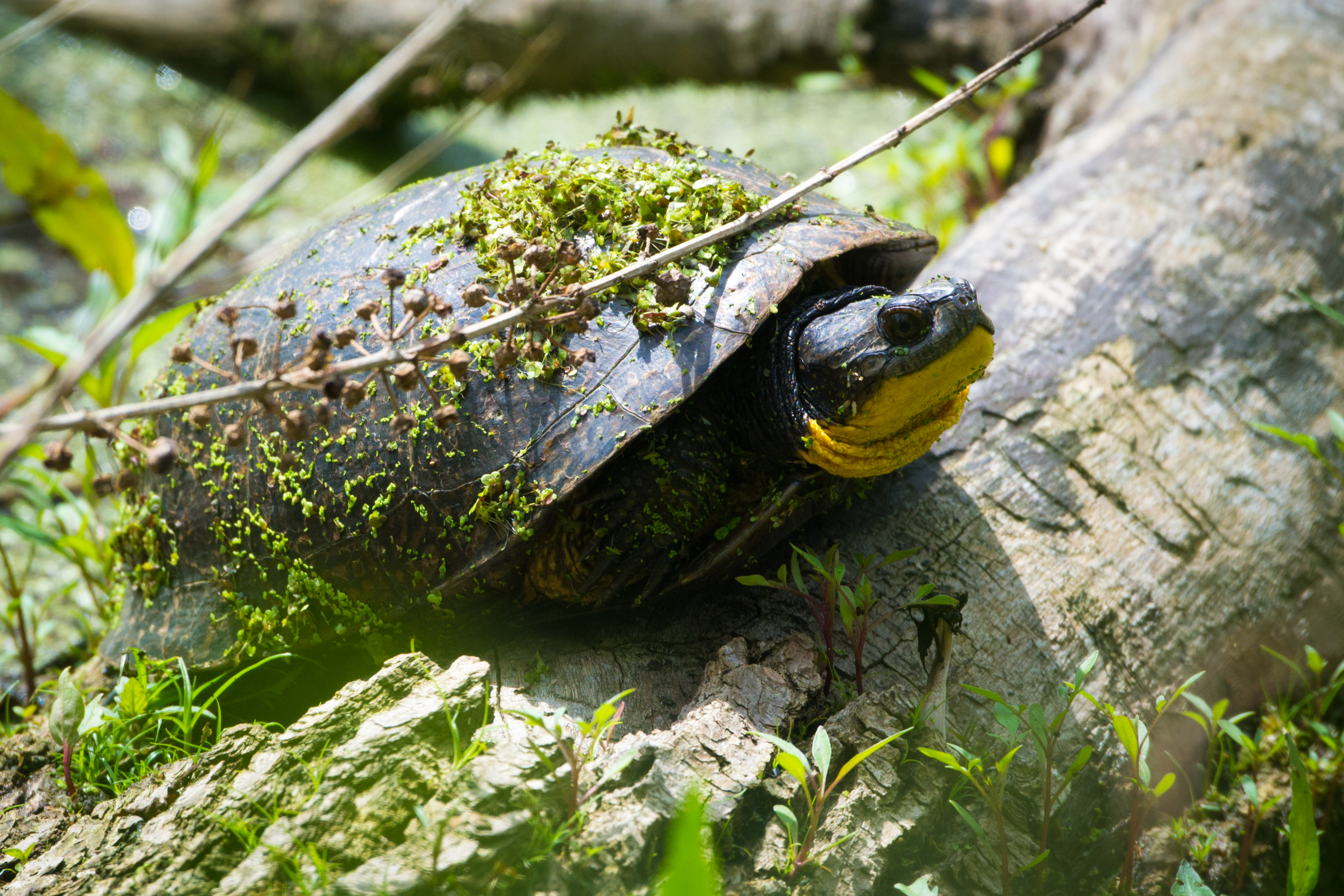
The flagship species of the Central US Forest-Grasslands Transition ecoregion is the Blanding's turtle. Image credit: Creative Commons
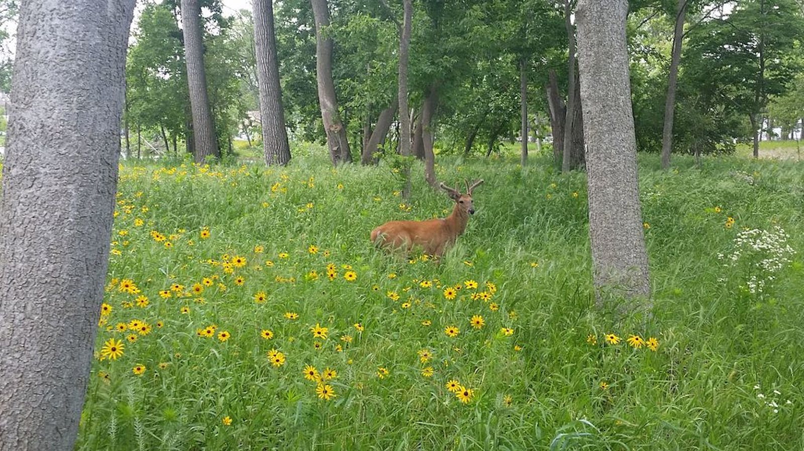
The natural vegetation of this transitional region is a mix of eastern deciduous forest, prairie, oak savanna, and other grasslands. The Wisconsin (glacial) Till Plains subregion contained a mosaic of oak savanna, bluestem prairie, maple-basswood forest, and oak-hickory forest. Forest occurred largely on moraines, along streams, and on dissected uplands, whereas prairie occurred on level to rolling uplands.
The nearly level Central Corn Belt Plains subregion was mostly covered by tallgrass prairie before conversion to agriculture. Sand dunes, forested bluffs, fens, and marshes were common in the Chicago Lake Plain portion of this subregion. The Interior River Valleys and Hills subregion has old till plains, hills, bluffs, major rivers, and valleys with levees, oxbow lakes, dunes, and other features. It is a transitional area between the prairies to the north and the Ozark Highlands and Interior Plateau forests to the south, southwest, and east. The Mississippi Alluvial Plain subregion had extensive deciduous forests and hardwood swamps.
Due to the extent of conversion of native vegetation to agriculture and urban use, many species are threatened or endangered. One particularly interesting species is Blanding’s turtle, considered endangered throughout much of its range in the Great Lakes region and the eastern Great Plains. This turtle, with a stunning yellow plastron (lower shell) with symmetrical dark blotches, shows little to no signs of aging and remains physically active and in reproductive condition after 8–9 decades of life.
The Central US Forest-Grasslands Transition ecoregion has lost more than 95% of its presettlement vegetation, and only 3% of the ecoregion is protected. That protected land is ecologically significant, however, and includes key sites such as the Chicago Wilderness network and The Nature Conservancy’s Nachusa Grasslands and Kankakee Sands preserves. Less than 1% of habitat remains outside protected areas.
Priority conservation actions for the next decade are to: 1) protect and expand existing remnants of natural vegetation, for example by preventing urban sprawl and restoring cropland to grassland or forest; 2) greatly increase federal, state, and local acquisition of conservation lands; and 3) improve management of existing conservation lands; and 4) reduce or eradicate populations of problematic exotic species.
Citations
1. White, J., and M. H. Madany. 1978. Classification of natural communities in Illinois. Pages 310-405 (Appendix 30) in J. White, Illinois Natural Areas Inventory Technical Report. Volume 1: Survey Methods and Results. Illinois Natural Areas Inventory, Department of Landscape Architecture, University of Illinois at Urbana/Champaign.
2. Ricketts, T.H. et al. 1999. Terrestrial Ecoregions of North America: A Conservation Assessment. Island Press, Washington, D.C.
3. Woods, A.J., J.M. Omernick, C.L. Pederson, and B.C. Moran. 2006. Level III and IV Ecoregions of Illinois. EPA/600/R-06/104. U.S. Environmental Protection Agency, Corvallis, OR.


