Eastern Canadian Shield Taiga
The ecoregion’s land area is provided in units of 1,000 hectares. The conservation target is the Global Safety Net (GSN1) area for the given ecoregion. The protection level indicates the percentage of the GSN goal that is currently protected on a scale of 0-10. N/A means data is not available at this time.
Bioregion: Canadian Shield & Coastal Taiga-Forests (NA9)
Realm: Subarctic America
Subrealm: Canadian Boreal Forests
Ecoregion Size (1000 ha):
75,626
Ecoregion ID:
374
Conservation Target:
99%
Protection Level:
0
States: Canada: QC, NL
The immense Eastern Canadian Shield Taiga ecoregion stretches from Hudson and James Bays of the Arctic Ocean east to the Labrador Sea of the Atlantic Ocean and north to the southern portion of Ungava Bay of the Arctic Ocean. The southwestern corner of Ungava Bay has the highest or second-highest tidal range in the world, with some sources estimating the spring tide range at the mouth of the Leaf River as high as 17 m. The western approximately two-thirds of this ecoregion is within Quebec and the eastern one-third within Newfoundland and Labrador.
The ecoregion is bounded on the southwest by the Southern Hudson Bay Taiga ecoregion, on the west by James and Hudson Bays, on the north by the Canadian Low Arctic Tundra ecoregion, Ungava Bay, and the Torngat Mountain Tundra ecoregions, on the east by the Labrador Sea, on the south and southeast by the Eastern Canadian Forests ecoregion, and on the south by the Central Canadian Shield Forests ecoregion.

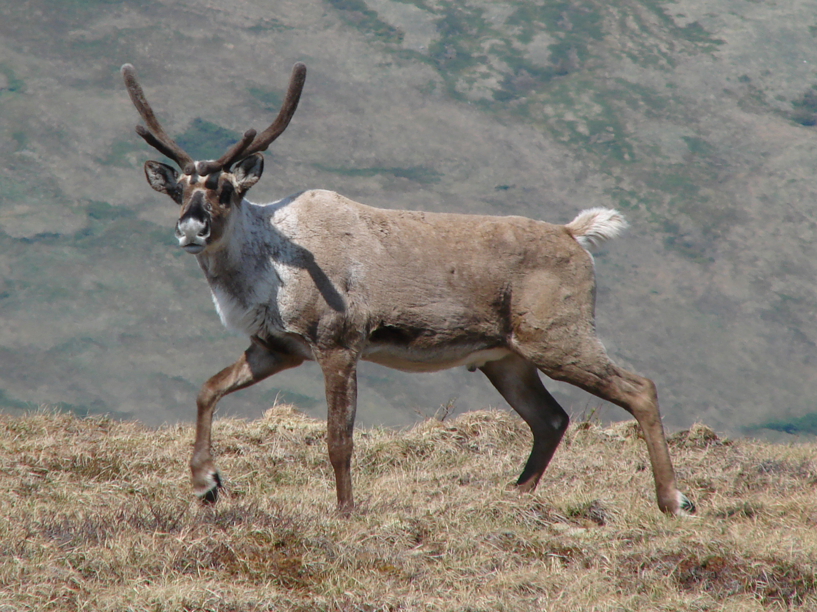
The George River barren-ground caribou (Rangifer tarandus groenlandicus) is the flagship species of the Eastern Canadian Shield Taiga ecoregion, located in the Canadian Shield & Coastal Taiga-Forests bioregion (NA9)
A surprisingly low 5% of this ecoregion is protected, but with 25% of habitat outside protected areas still intact, there is still opportunity to greatly scale up protection.
The western portion of the Eastern Canadian Shield Taiga ecoregion is composed of the Larch Plateau and the Richmond Hills, with elevations ranging from 150 m near the coast of James Bay to 450 m further east. The Kaniapiskau Plateau forms the core of Lake Plateau in the central and south-central portion of the ecoregion, with elevations reaching 915 m.
An escarpment runs from northwest to southeast through the center of the ecoregion overlooking the Labrador Hills, which are sinuous ridges with summits ranging from 360 m to 730 m. The coast of the Labrador Sea has steep-sided, rounded mountains with deeply incised U-shaped valleys and fjords extending inland. The southeastern edge of the ecoregion is level to gently undulating peatland interrupted by glacial features and rivers. The climate of most of this ecoregion ranges from low to high subarctic, with cool summers and very cold winters. The coast of the Labrador Sea, however, is milder.
The mean annual temperature across the ecoregion ranges from -6°C to 1°C, with lower temperatures near Hudson Bay and warmer in eastern Labrador. Mean summer temperatures range from 5.5°C to 10°C, and winter temperatures from -18°C to -1°C. Mean annual precipitation varies from 300–400 mm in vicinity of Ungava Bay to 1000 mm in the southeastern part of this ecoregion. Patchy permafrost occurs throughout the ecoregion, especially under wetlands, and the entire ecoregion was glaciated during the Pleistocene.

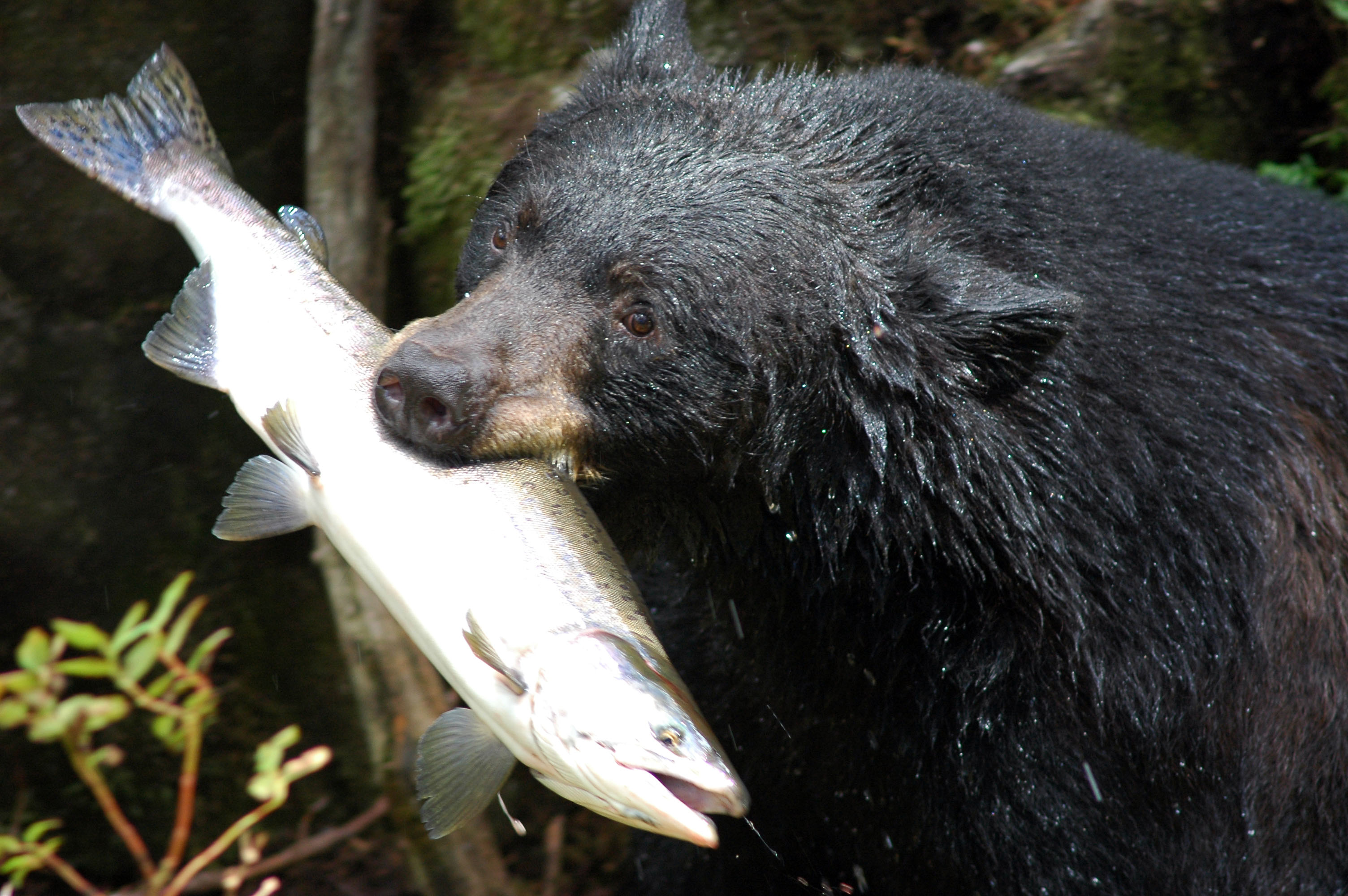
Black bear with salmon
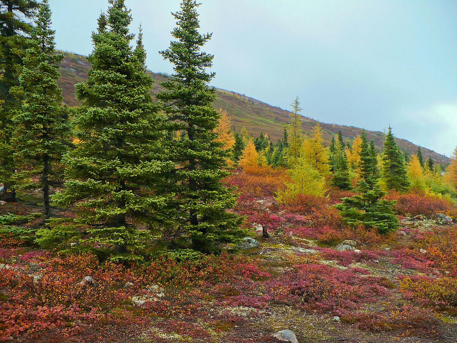
The dominant vegetation is open, stunted woodlands of black spruce and tamarack. Balsam fir is uncommon and restricted to sites with medium-textured soils. Other important species are white spruce, dwarf birch, willow, ericaceous (heath family) shrubs, cottongrass, lichens, and mosses. Sedges, Labrador tea, cottongrass, and Sphagnum moss dominate poorly drained sites. A tree line occurs at the northwestern boundary of this ecoregion, and vegetation cover becomes sparse in the vicinity of Ungava Bay.
On the coast of the Labrador Sea, a closed to open forest of low white spruce is most common, but coastal heath dominates headlands and ridges, and cliff summits are mostly exposed bedrock with lichens and mosses restricted to crevices. Salt marshes and bogs also occur along the coast.
Mammals of this ecoregion include caribou, moose, black bear, wolf, red fox, arctic fox, wolverine, and snowshoe hare. Importantly, this ecoregion contains most of the year-round range of the George River barren ground caribou herd, which was once the world’s largest migratory herd with 800,000–900,000 animals. The herd is genetically and morphologically more similar to woodland caribou, but behaves like barren ground caribou.
Their numbers began dropping precipitously after the 1990s, apparently due to several factors, including human overpopulation and resulting degradation of food supply in the wild, as well as road-building and over-hunting. By 2016 only 8,938 animals remained—a 99% decline.
A small (estimated to be less than 100 animals) and highly imperiled population of land-locked freshwater seals (an endemic subspecies of harbor seal) inhabits Lac des Loups Marins, Quebec. The population is harvested at apparently low levels by the Cree and is threatened by potential hydroelectric development and mining exploration.
Although 99% of the habitat of this ecoregion remains intact, dramatic population declines of species such as caribou and the Lac des Loups Marins seal shows that humans are having a profound impact.
Priority conservation actions for the next decade:
- Vastly increase federal and provincial designation of conservation lands.
- Ban hunting and proactively pursue the recovery of declining animal populations.
- Place a moratorium on road-building, hydroelectric development, mining, and commercial logging.
-
-
1. Ricketts, T.H. et al. 1999. Terrestrial Ecoregions of North America: A Conservation Assessment. Island Press, Washington, D.C.
2. Elliott-Fisk, D.L. 2000. The taiga and boreal forest. In M.G. Barbour and W.D. Billings, editors. North American Terrestrial Vegetation, 2nd edition. Cambridge University Press, Cambridge, U.K.
3. Eastern Canadian Shield Taiga. https://www.revolvy.com/page/Eastern-Canadian-Shield-taiga?cr=1 -
Cite this page: Eastern Canadian Shield Taiga. Ecoregion Snapshots: Descriptive Abstracts of the Terrestrial Ecoregions of the World, 2021. Developed by One Earth and RESOLVE. https://www.oneearth.org/ecoregions/eastern-canadian-shield-taiga/
-


