New Britain-New Ireland Lowland Rainforests
The ecoregion’s land area is provided in units of 1,000 hectares. The conservation target is the Global Safety Net (GSN1) area for the given ecoregion. The protection level indicates the percentage of the GSN goal that is currently protected on a scale of 0-10. N/A means data is not available at this time.
Bioregion: New Guinea & Surrounding Islands (AU13)
Realm: Australasia
Ecoregion Size (1000 ha):
3,515
Ecoregion ID:
144
Conservation Target:
82%
Protection Level:
0
States: Papua New Guinea
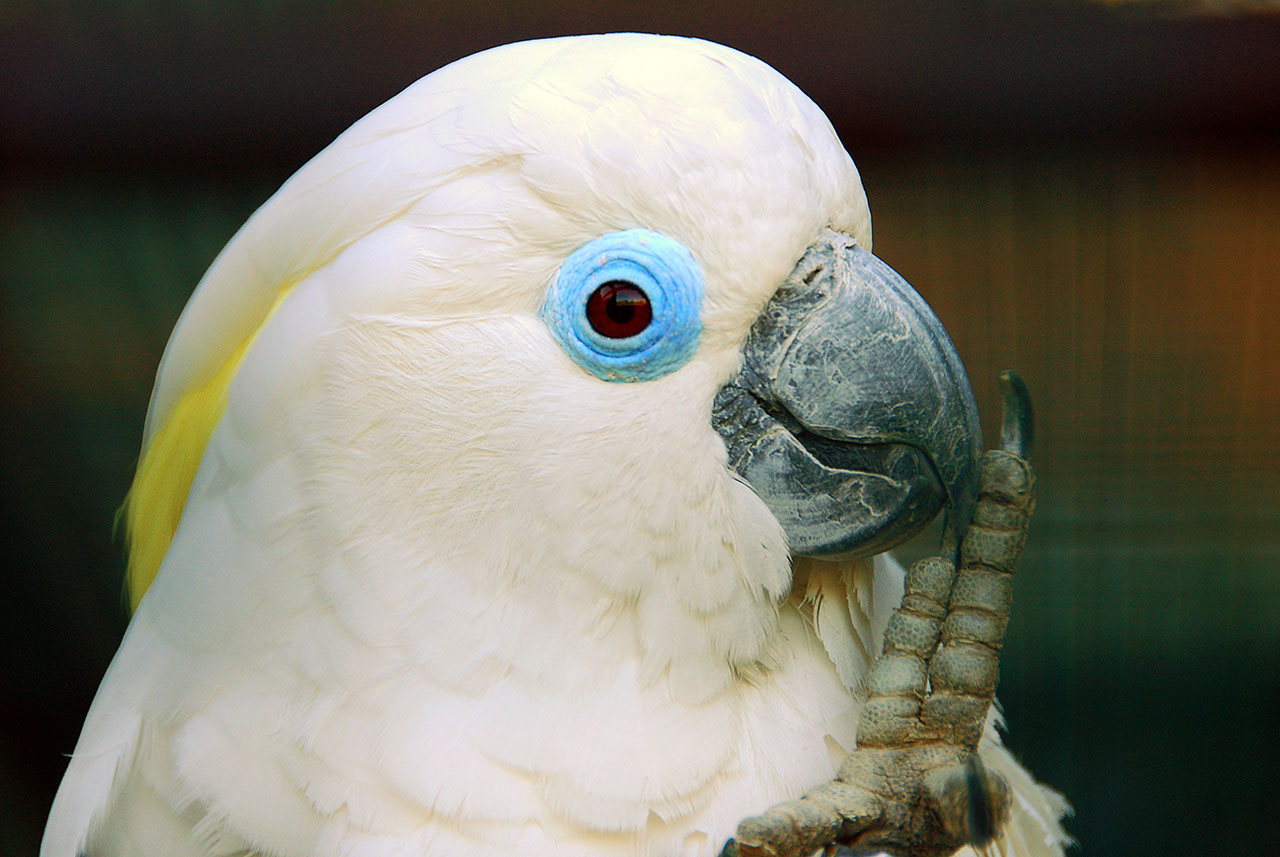
Volcanoes and uplifted limestone in the Bismarck Archipelago have built two large, long, and narrow islands off the northeast coast of New Guinea—New Britain and New Ireland. Their large size, height, and isolation have given rise to a large number of endemic species of both plants and animals. Many of the archipelago’s unique species have counterparts on the adjacent New Guinea and Solomon Islands, though they remain distinct in look and behavior. Some are subtly beautiful, like the ochre-necked New Britain sparrowhawk and blue-eyed cockatoo.

The flagship species of the New Britain-New Ireland Lowland Rainforests ecoregion is the blue-eyed cockatoo. Image credit: Wikimedia Commons
The Bismarck Archipelago is dominated by New Britain and New Ireland (both over 400 kilometers in length), though St. Matthias Islands, New Hanover, and many associated islands are also part of the archipelago. Despite its proximity to New Guinea and the existence of small islands that appear to be remnants of a land bridge, the island arc was never connected to the mainland. Many active volcanoes still exist (particularly in New Britain). Most of the islands are made up of volcanic (acidic) soils and limestone: 30 percent of New Britain and nearly 40 percent of New Ireland, or the entire northern half, are limestone.
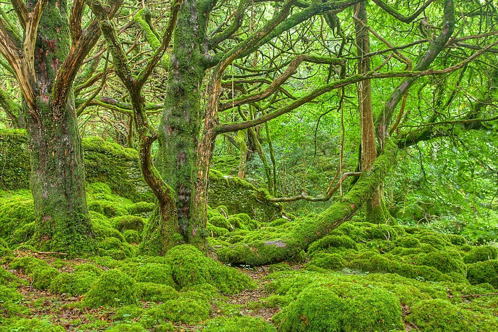
The lowland rain forests ecoregion includes all of the Bismarck Archipelago below 1,000 meters. The climate of the ecoregion is tropical wet but varies dramatically in the average annual rainfall from about 1,500 millimeters to more than 6,000 millimeters, depending on the location. New Britain and New Ireland are both long and narrow and contain several mountain ranges that trap rainfall that helps maintain tall lowland rain forests.
Major lowland rainforest tree genera include Pometia (Sapindaceae), Octomeles (Datiscaceae), Alstonia (Apocynaceae), Campnosperma (Anacardiaceae), and Canarium (Burseraceae). Freshwater swamp forests support Campnosperma brevipetiolata, Terminalia brassii, sago palm (Metroxylon sagu), and screwpine (Pandanus spp.). Limestone forests near the coast of southern New Ireland and along the coast and interior of New Britain are dominated by Vitex cofassus.
The Bismarck Archipelago is noted for its rich fauna of bats, rodents, pigeons, frogs, and lizards. Among the 47 mammals, 36 are bats in four families (Pteropodidae, Emballonuridae, Rhinolophidae, and Vespertilionidae), and most of the rest are murid rodents. Umboi Island lies between New Britain and mainland New Guinea and is remarkable for having eight species of fruit bats. The lowlands of New Britain and New Ireland contain 19 endemic and 36 near-endemic species. Two of these are endemic to the St. Matthias Islands, one to New Hanover, one to Feni, ten to New Britain, and five to New Ireland. Several species are listed as threatened by IUCN, including New Guinea pademelon, Gilliard's flying-fox, large-eared sheathtail-bat, Bismarck trumpet-eared bat, and New Britain water-rat.
Much of the coastal and lowland forest has been converted to palm oil plantations, copra, cacao, traditional agriculture, settlements, or man-made savannas over the past few decades, especially on New Britain and much of New Ireland. The forests along the southern coast of New Britain is particularly impacted by mechanized and portable sawmill logging. St. Mathias Island has virtually no primary forest left. Logging also removes important nesting trees for vulnerable species, such as the Blyth’s hornbill, while the opening of logging roads also facilitates the access of invasive species, including rats, feral dogs, feral pigs, and cane toads, to native forest areas where they colonize natural habitats and prey on native species.
The archipelago only has a few very small formal protected areas, such as Pokili, Tavalo, and Garu Wildlife Management Areas, covering only approximately three percent of the ecoregion. Traditional and community-based protection of forests, with the support of local and provincial government, is the best approach for forest conservation, particularly in Key Biodiversity Areas such as the Gloucester Volcanics, Arawe, Gasmata, and East Mengen on New Britain, Cape St. George, Lavongai, lowlands of the Lepet Plateau, and Madina on New Ireland, and Mussau on New Hanover.
Priority conservation actions for the next decade
- Put in place community-managed protection for these identified Key Biodiversity Areas.
- Monitor and reduce the unsustainable rate of forest logging operations in several of these areas where relatively intact lowland forests are still retained.
- Protect the last lowland to montane forest altitudinal blocks to maintain habitat continuity and connectivity.
-
-
- Adams VM, VI Tulloch, HP Possingham. 2017. Land-sea conservation assessment for Papua New Guinea. A report on the work undertaken to fulfill the terms of the project Review and Integration of the Terrestrial and Marine Program of Works on Protected Areas. PNG CEPA, University of Queensland, Global Environment Facility, UNDP, Brisbane. 75 pp.
- Beehler BM, TK Pratt. 2016. Birds of New Guinea Distribution, Taxonomy, and Systematics. Princeton University Press, Princeton.
- CEPF. 2012. Ecosystem Profile: East Melanesian Islands Biodiversity Hotspot. Critical Ecosystem Partnership Fund, Washington DC.
-
Cite this page: New Britain-New Ireland Lowland Rainforests. Ecoregion Snapshots: Descriptive Abstracts of the Terrestrial Ecoregions of the World, 2021. Developed by One Earth and RESOLVE. https://www.oneearth.org/ecoregions/new-britain-new-ireland-lowland-rainforests/
-


