Northern Annamites Rainforests
The ecoregion’s land area is provided in units of 1,000 hectares. The conservation target is the Global Safety Net (GSN1) area for the given ecoregion. The protection level indicates the percentage of the GSN goal that is currently protected on a scale of 0-10. N/A means data is not available at this time.
Bioregion: Indochina Mixed Forests & Peatlands (IM12)
Realm: Indomalaya
Ecoregion Size (1000 ha):
4,731
Ecoregion ID:
255
Conservation Target:
72%
Protection Level:
4
States: Laos, Vietnam
The discovery of a new mammal or bird is a newsworthy event today. But to discover several large and mid-sized mammals in quick succession is truly amazing. These discoveries epitomize the globally outstanding biological diversity of the Northern Annamites Rain Forests ecoregion.
The first mammal to be discovered and described here was the enigmatic saola, a mid-sized ungulate that is so unique and distinctive that it was assigned an entirely new genus. The dark chocolate brown animals have distinctive white facial markings and long straight horns, which have earned it another name, the ‘Asian bicorn’. The saola was first discovered in 1992 by a team of biologists that were exploring the remote Vu Quang National Park in Vietnam when they found a skull in the house of a local hunter. Very little information has emerged of this animal since then.
.jpg)
The flagship species of the Northern Annamites Rainforests ecoregion is the saola. Image credit: iNaturalist
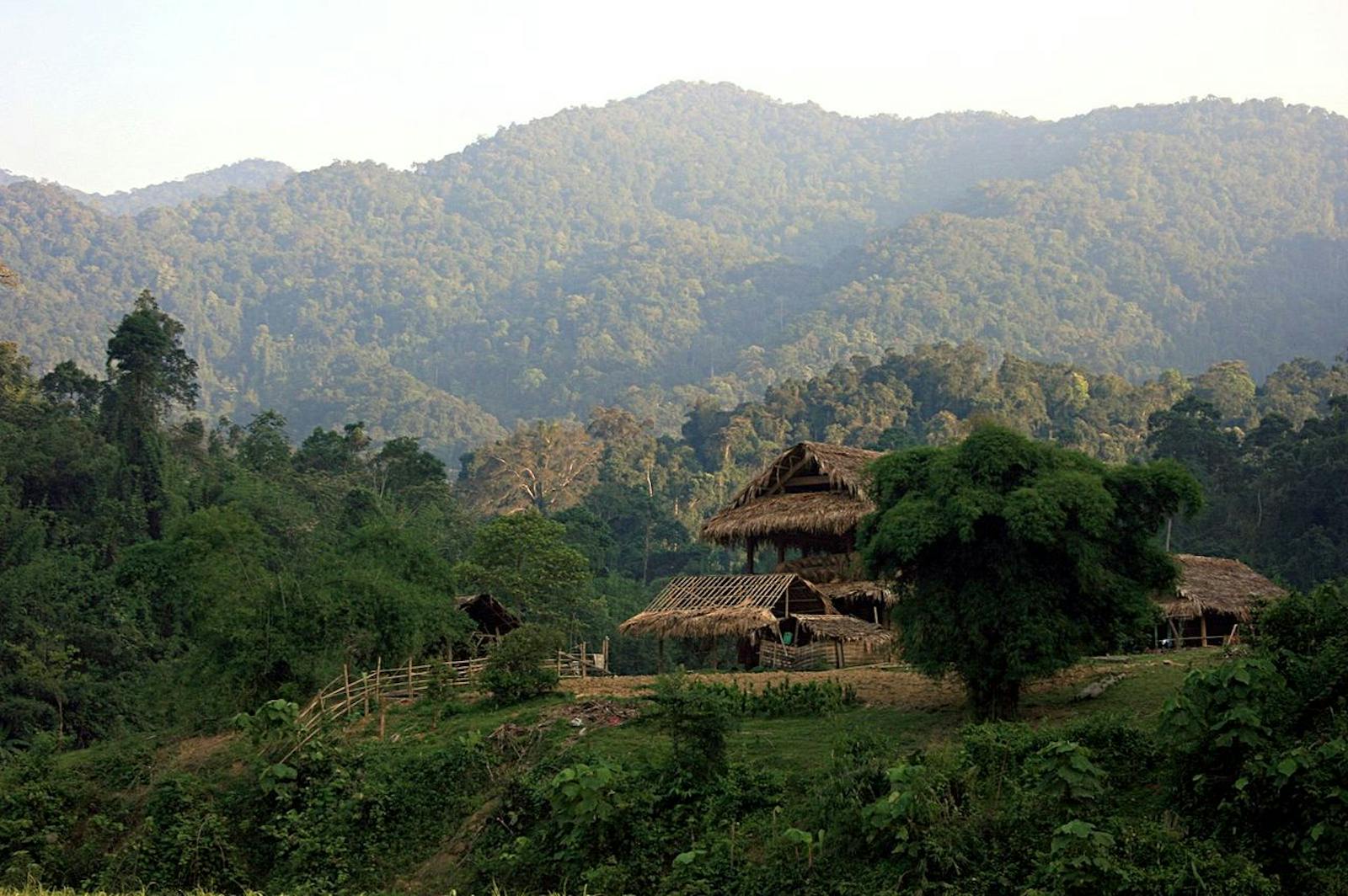
The ecoregion straddles the Annamite, or Troung Son, mountain range and the international boundary between Laos and Vietnam. Geologically, the mountains consist of limestone karst, and is deeply incised, steep, rugged, and largely inaccessible. The complex topography creates highly varied climatic conditions along the mountains, but overall the eastern slopes in Vietnam intercept the monsoon storms and receive over 3,800 mm of rainfall annually, while the rain shadow effect on the western side in Laos results in much less rainfall.
The forest vegetation is influenced by the complex interactions of rainfall, topography, and substrate. The lower montane forests, up to 1,200 m in elevation, generally consists of trees in the families of Myrtaceae, Fagaceae, Elaeocarpaceae, and Lauraceae. The trees are festooned with epiphytes, especially orchids and tree ferns. Because very little light penetrates the dense canopy, the understory is sparse, but usually supports thick stands of woody bamboo.

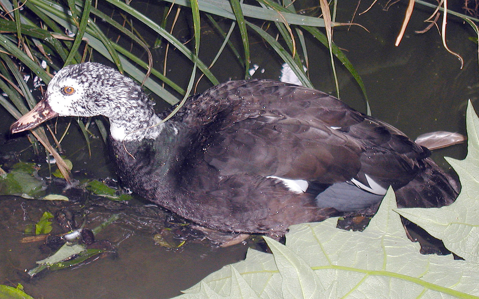
White-winged wood duck. Image credit: Creative Commons
Frequent typhoons create a natural disturbance regime that opens up forest gaps, promoting growth and establishment of the bamboo groves. Between 1,200 and 1,800 m the humid forests are dominated by Fokienia hodginsii, Podocarpus imbricatus, and Cunninghamia lanceolata. Above 1,500 m, where the soil is thin and acidic, pine forests of Pinus kesiya dominates. In some areas of northern Laos the montane pine forests are dominated by Keteleeria evelyniana, which may occur in pure stands or mixed with Pinus kesiya.
Over 135 species of mammals are known from this ecoregion. Many of the charismatic megavertebrates such as the tiger and Asian elephant have almost been extirpated from this ecoregion, but there are several rare and endangered mammals that are of conservation significance and should be focal species for conservation, especially since unsustainable shifting cultivation rotations and expansions, infrastructure development, and logging are degrading and fragmenting the forests. These species include the saola and other ‘recent discoveries’ such as the giant muntjac, Truong Son muntjac, Annamite striped rabbit, and primates, especially the several species of gibbons and douc langurs. The rich bird fauna, estimated at over 525 species, also includes several forest dwelling species, such as the imperial pheasant, Edwards’s pheasant, and Vietnamese fireback.

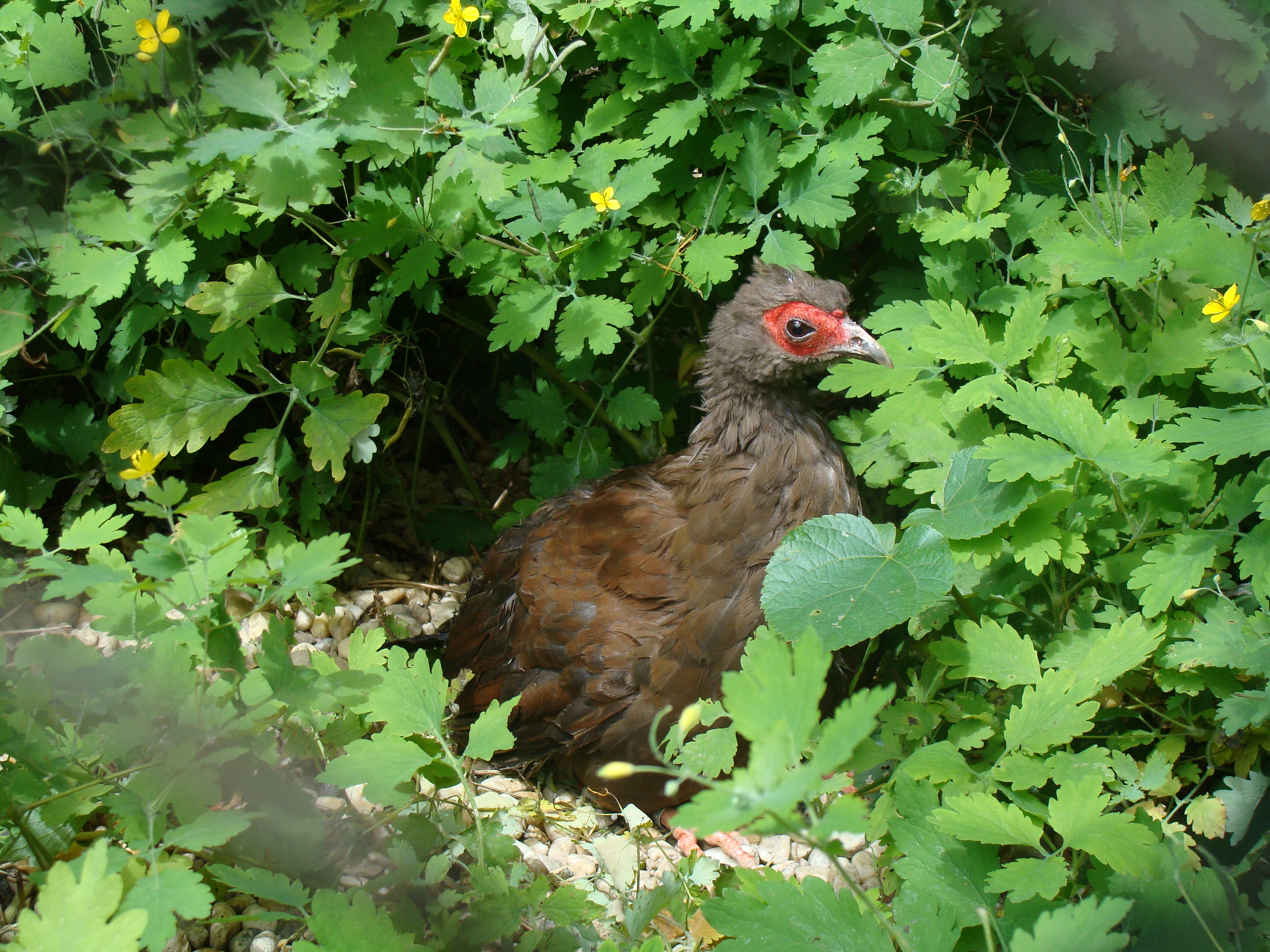
Edwards’s pheasant. Image credit: Creative Commons
About 31% of the ecoregion receives formal protected area status. Another 44% of the ecoregion’s forests remain outside the protected areas system. However, none of the reserves have effective protection or conservation management. Hunting of all wildlife, irrespective of size or taxon, is both extensive and intensive.
Thus, the recommended conservation interventions are to: 1) increase the extent of protection for more representation, especially because of the high endemism and species turnover across the ecoregion’s landscape; 2) support effective protection and monitoring; and 3) implement programs to engage local communities in conservation.
Citations
1. Wikramanayake, E, E. Dinerstein, et al. 2002. Terrestrial Ecoregions of the Indo-Pacific: A Conservation Assessment. Island Press.
2. Critical Ecosystems Partnership Fund. 2012. Ecosystem Profile. Indo-Burma Biodiversity Hotspot. 2011 Update. https://www.cepf.net/Documents/final.indoburma_indochina.ep.pdf Accessed Dec 2017.
3. Greater Mekong Subregion Atlas of the Environment. 2nd ed. Asian Development Bank. 2012. https://www.adb.org/sites/default/files/publication/30074/gms-atlas-environment-2nd-edition.pdf. Accessed Dec 2017


