Sundarbans Mangroves
The ecoregion’s land area is provided in units of 1,000 hectares. The conservation target is the Global Safety Net (GSN1) area for the given ecoregion. The protection level indicates the percentage of the GSN goal that is currently protected on a scale of 0-10. N/A means data is not available at this time.
Bioregion: North Indian Tropical Forests & Sundarbans (IM6)
Realm: Indomalaya
Ecoregion Size (1000 ha):
2,048
Ecoregion ID:
323
Conservation Target:
35%
Protection Level:
9
States: Bangladesh, India
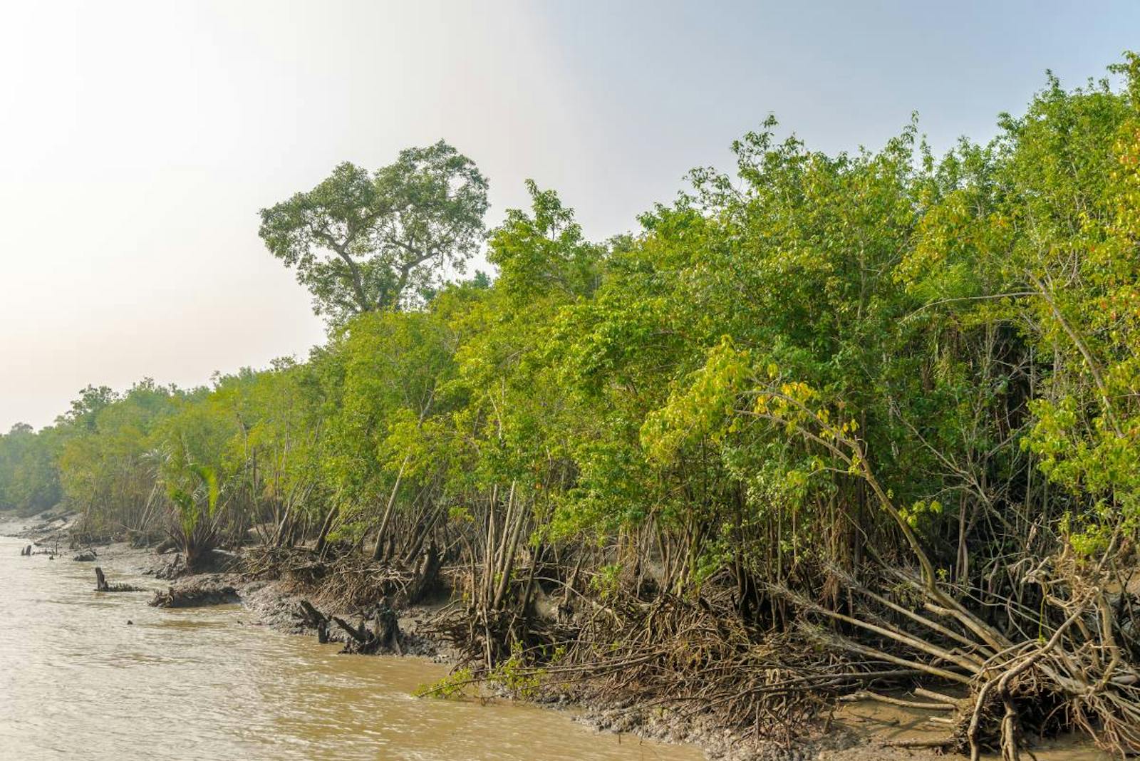
The Sundarbans is the largest mangrove ecosystem in the world. Named after the dominant mangrove tree species, Heritiera fomes, known as sundri in Bengali, Sundarbans itself literally means ‘beautiful forest’ in Bengali. The ecosystem is now one of the World’s Natural Wonders, and was declared a UNESCO World Heritage Site.
This mangrove is unique in that it supports a large, viable population of Asia’s largest predator, the tiger, living and swimming among the mangrove islands, searching for and preying on chital deer, wild pig, and even macaque monkeys. The people who venture into these mangrove forests to gather honey, fish, and cut trees to make charcoal also fall victim to the tigers on occasion.
_1_Wikimedia%20Commons.jpg)
The flagship species of the Sundarbans Mangroves eocregion is the Heritiera fomes. Image credit: Creative Commons
The Sundarbans Mangrove ecoregion lies in a vast delta, an area over 10,000 km2 formed by the confluence of South Asia’s largest rivers, the Ganges, Hooghly, Padma, Brahmaputra and Meghna. Strong monsoons from the Bay of Bengal bring heavy rains and devastating cyclones that cause widespread destruction. Annual rainfall exceeds 3,500 mm, and daytime temperatures can reach a stifling 48°C during the monsoon months.
The mangroves are not as diverse compared to most other terrestrial ecosystems. Undisturbed forests have a dense canopy and an undergrowth of seedlings and saplings of the canopy trees. While the tree community is dominated by Heritiera, other mangrove trees include species of Avicennia, Xylocarpus, Sonneratia, Bruguiera, Cereops, Aegicera, and Rhizophora. Nipa, a palm adapted to estuaries and mangroves, line the channels.
In addition to the tiger and its prey species, the mangrove islands of this ecoregion also support several other threatened mammals, including fishing cats, jungle cats, pangolins, and flying foxes. As its name implies, the fishing cat, a mid-sized wild cat with leopard-like spots gets into the water to catch fish and crabs along the channel edges. The channels also harbor large, dangerous predators.

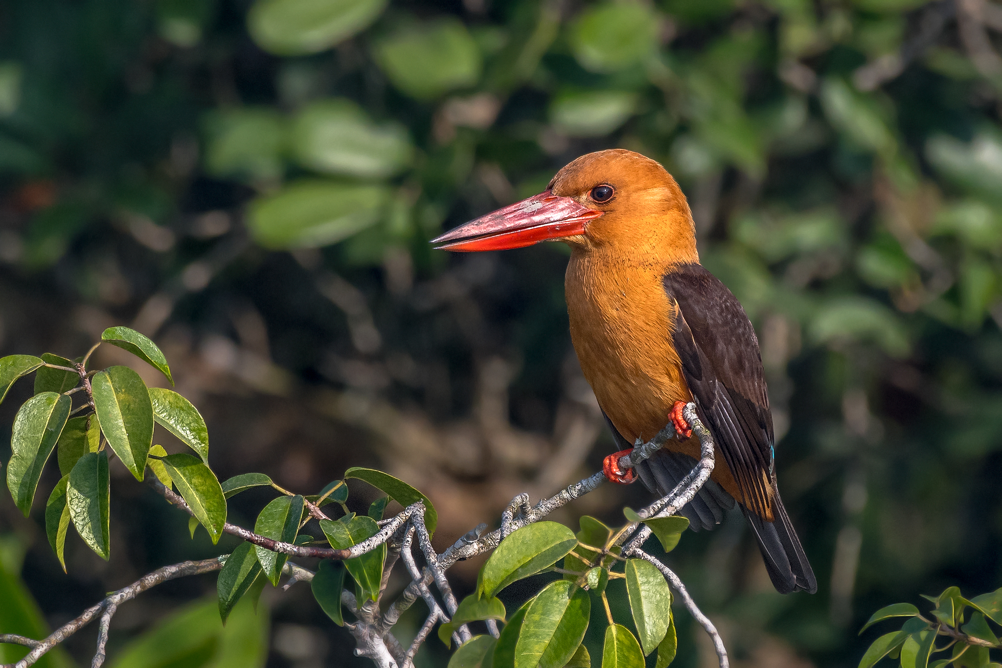
Brown-winged kingfisher. Image credit: Creative Commons
Two species of crocodiles, the mugger and the salt-water crocodile, inhabit the waterways and the shores. The water monitor lizard, which can grow up to 9 feet in length and is the second largest lizard in the world, uses both land and water to hunt. Sharks and the Gangetic dolphins patrol the waterways. More unobtrusive but equally fascinating are the mudskippers, an air-breathing fish that climbs out of the water into mudflats and even climbs trees. More than 170 bird species are known from the mangrove forests, including 12 birds of prey that coexist.
This ecoregion extends across two countries with some of the highest human population densities in the world; thus anthropogenic threats are intense. About half of the mangrove forests have been cut for fuelwood. Shrimp fry are being collected at unsustainable levels to supply the shrimp grow-out industry, and forests are cleared for grow-out ponds. River diversion and impoundment projects upriver are affecting the delicate balance of salinity and tidal fluxes that maintain this ecosystem.
_male-CC-Charles%20J%20Sharp-2017.jpg)
Gharial. Image credit: Charles J Sharp, Creative Commons
Some of the more severe threats originate thousands of kilometers away: the rivers that feed and flush the mangroves carry heavy silt loads from eroding deforested Himalayan mountain slopes. This silt-laden, turbid water has profound impacts on the sensitive mangrove ecosystems, smothering the eggs and juveniles of fishes and shellfishes that use the mangroves as nurseries.
Although large areas of the Sundarbans are now protected, conservation actions are needed to: 1) strengthen the existing protected area network and implement management plans; 2) develop an effective patrol and monitoring system; and 3) maintain appropriate hydrologic and flow regimes to ensure the ecological balance of the mangrove system.
Citations
1. Gopal, B. and Chauhan, M., 2006. Biodiversity and its conservation in the Sundarban Mangrove Ecosystem. Aquatic Sciences-research across boundaries, 68(3), pp.338-354.
2. Iftekhar, M.S. and Islam, M.R., 2004. Managing mangroves in Bangladesh: A strategy analysis. Journal of Coastal Conservation, 10(1), pp.139-146.
3. Wikramanayake, E, E. Dinerstein, et al. 2002. Terrestrial Ecoregions of the Indo-Pacific: A Conservation Assessment. Island Press.

.jpg?auto=compress%2Cformat&w=1600)
_3_Wikimedia%20Commons.jpg?auto=compress%2Cformat&w=1600)
_2_Flickr.jpg?auto=compress%2Cformat&w=1600)


