Tamaulipan Mezquital
The ecoregion’s land area is provided in units of 1,000 hectares. The conservation target is the Global Safety Net (GSN1) area for the given ecoregion. The protection level indicates the percentage of the GSN goal that is currently protected on a scale of 0-10. N/A means data is not available at this time.
Bioregion: Sierra Madre Forests & Mexican Drylands (NA29)
Realm: Northern America
Ecoregion Size (1000 ha):
12,557
Ecoregion ID:
437
Conservation Target:
54%
Protection Level:
2
States: United States: TX. Mexico: TM, NL, CO
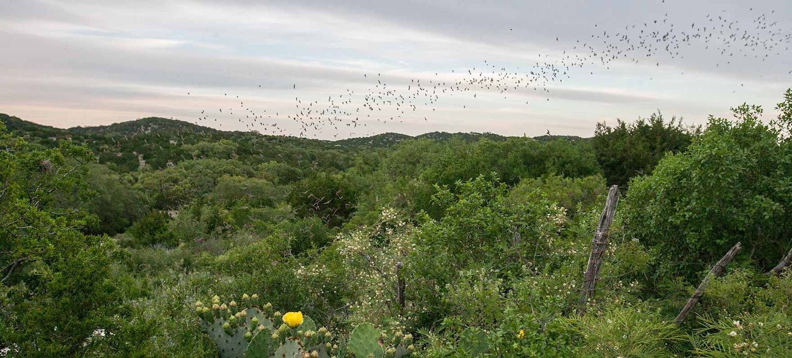
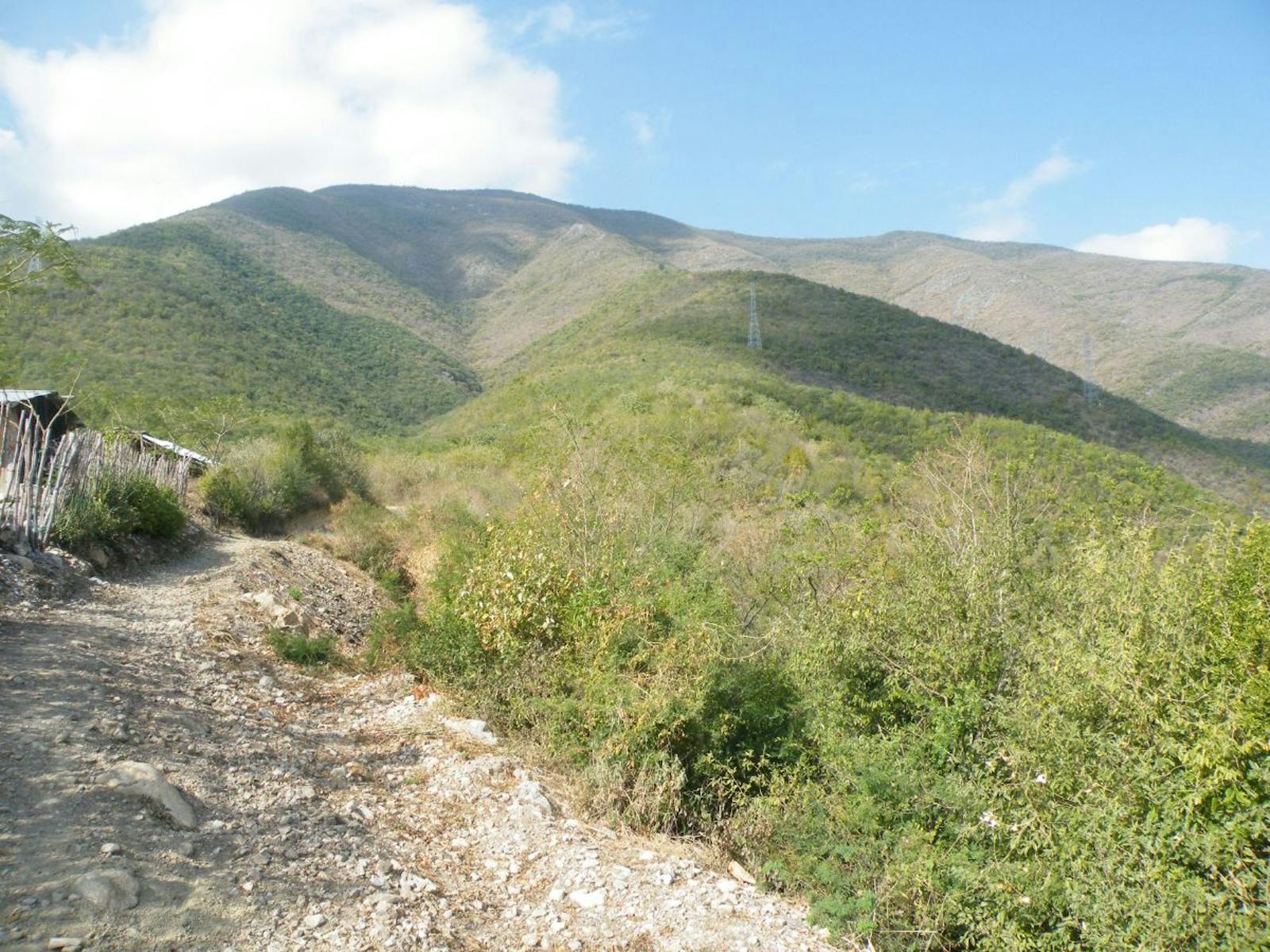
The Tamaulipan Mezquital ecoregion occupies the southwestern portion of the Gulf Coastal Plain in southern Texas and northeastern Mexico. It is entirely within the North American Coastal Plain, which in 2016 was formally recognized by the Critical Ecosystem Partnership Fund as the 36th global biodiversity hotspot. It stretches from the western outskirts of San Antonio, Texas, south to the boundary between the Nearctic and Neotropic Realms in the vicinity of General Zaragoza, Tamaulipas, and northwest to the area west of the Amistad Reservoir of the Rio Grande River.
.jpg)
The flagship species of the Tamaulipan Mezquital is the ocelot. Image credit: Erick Kilby, Creative Commons
This river flows through the middle of the ecoregion on its way to the Gulf of Mexico and divides the United States and Mexico. The Texas portion of this ecoregion is often called the South Texas Brush Country. Surrounding ecoregions are the Edwards Plateau ecoregion to the north, the Texas Blackland Prairies and East Central Texas Forests to the northeast, the Western Gulf Coastal Grasslands to the east, the Veracruz Moist Forests and Tamaulipan Matorral to the south and southwest, and the Chihuahuan Desert and Sierra Madre Oriental Pine-Oak Forests to the west.
Given this geographic position, the Tamaulipan Mezquital is truly an ecological crossroads between east and west and subtropical and tropical, which helps explain its high biodiversity.
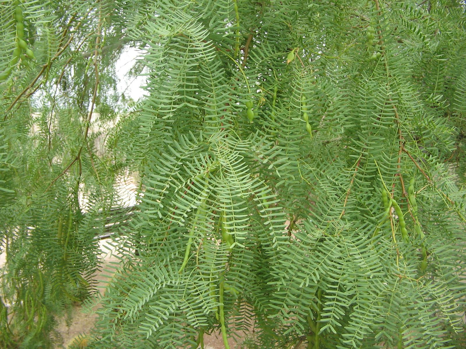
This climate of the Tamaulipan Mezquital is semiarid subtropical, though winds from the Gulf of Mexico keep the region considerably humid for much of the year. Average annual precipitation over most of the ecoregion is in the 400-1000 mm range. Vegetation across the ecoregion is extremely variable, but the defining plant community is mesquite grassland dominated by honey mesquite and curly mesquite grass, with other common plants including chaparro and jazmincillo.
There are also open woodlands of mesquite with a grassy understory of taller species such as hooded finger grass over a layer of shorter grasses such as grama grasses. Tamaulipan thornscrub is dominated by spiny shrubs and trees over grasses, forbs, and succulents. Higher, rocky sites with shallow soils support a medium-stature shrubland with blackbrush, guajillo, cenizo, and other species. Lower, flatter sites with deeper soils had mesquite and taller woody plants openly spaced over grasses (i.e., a savanna). Plants common on such sites, besides mesquite, are: granjeno, lotebush, prickly-pear, and brasil.
The savanna-woodland-grassland that characterized much of the ecoregion has become much more shrubby since European settlement, due to various factors including overgrazing and fire exclusion. The Rio Grande in this ecoregion was called Rio de las Palmas by some early Spanish explorers because of the abundant Mexican sabal palm that grew along its banks up to 130 km upriver from the Gulf. Montezuma bald cypress grew 160 km upriver.

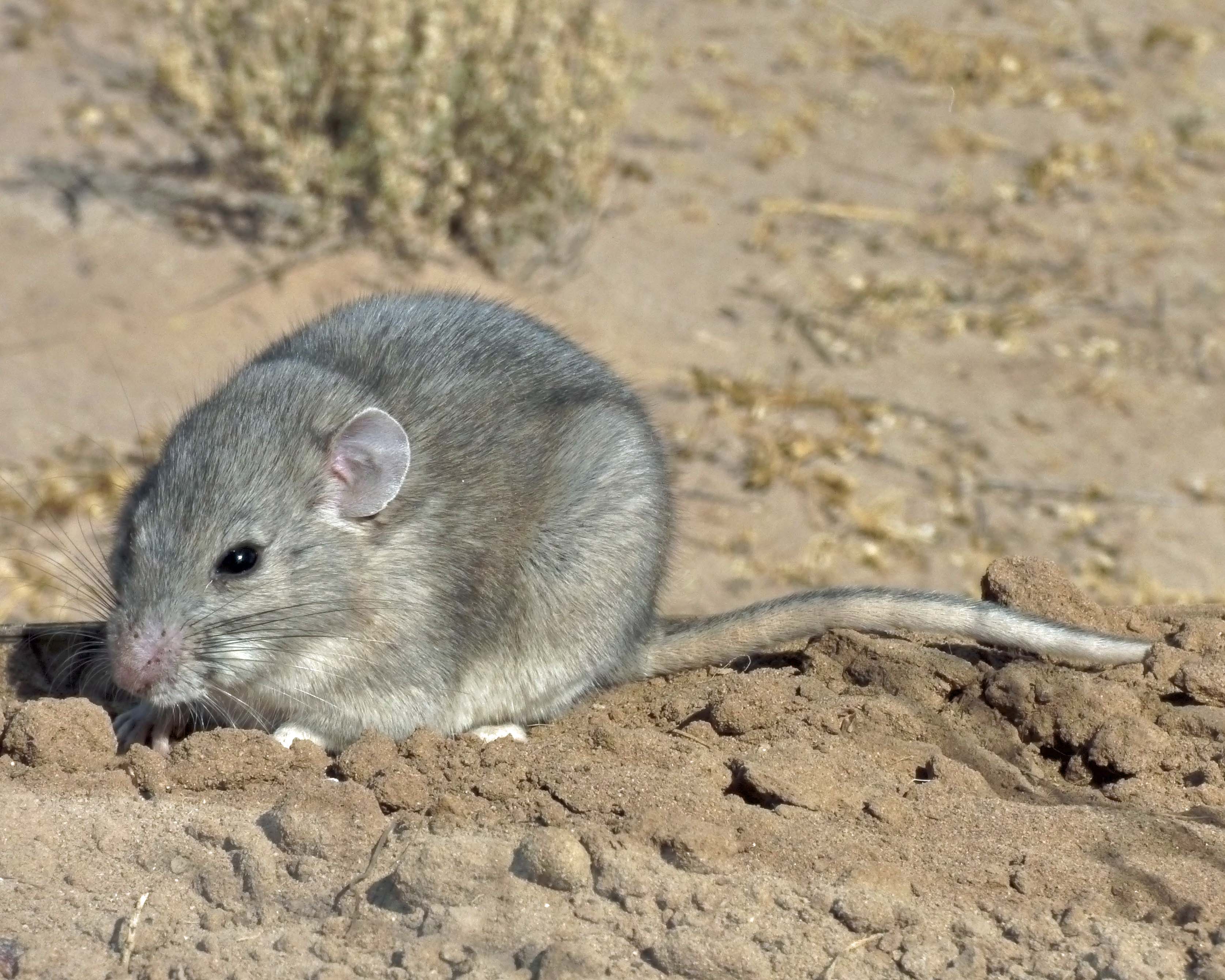
Southern Plains wood rat. Image credit: Creative Commons
Other plants in the Rio Grande Valley include Texas ebony, snake-eyes, barreta, palo verde, and anacahuita. Creosote bush becomes common close to the Chihuahuan Desert, where precipitation is lower. Other communities include live oak woodlands and riparian woodlands along some streams, with sugar hackberry, cedar elm, anaqua, and other species. The lower Rio Grande, including the delta, is a botanical hotspot with high species richness and many rare and endemic plants.
Animals characteristic of this ecoregion include ocelot, jaguarundi, Texas indigo snake, and more than 400 species of birds. Some distinctive birds include hook-billed kite, white-tailed kite, gray hawk, white-winged dove, white-tipped dove, green parakeet, greater roadrunner, groove-billed ani, golden-fronted woodpecker, northern beardless-tyrannulet, vermillion flycatcher, scissor-tailed flycatcher, great kiskadee, rose-throated becard, Tamaulipas crow, Chihuahuan raven, green jay, black-crested titmouse, cactus wren, long-billed thrasher, hooded oriole, and olive sparrow.
Unfortunately, this ecoregion has been highly degraded by human activity, especially agriculture and livestock grazing, and only 8% is protected; 23% of habitat outside protected areas remains intact. Conversion of land to agriculture, intensive livestock grazing, and urban expansion are the most serious threats to this ecoregion.
Priority conservation actions for the next decade are: 1) greatly expand the network of protected areas to encompass all remaining intact habitat and better represent ecosystem diversity; 2) reduce livestock grazing throughout the ecoregion; and 3) constrain urban sprawl.
Citations
1. Ricketts, T.H. et al. 1999. Terrestrial Ecoregions of North America: A Conservation Assessment. Island Press, Washington, D.C.
2. Poole, J.M., W.R. Carr, D.M. Price, and J.R. Singhurst. 2007. Rare Plants of Texas. Texas A&M University Press, College Station.
3. Tamaulipan Mezquital. https://en.wikipedia.org/wiki/Tamaulipan_mezquital


